Scan to BIM for Infrastructure Maintenance: When It Pays
Scan to BIM is worth it for maintaining existing infrastructure when the decision you are about to make depends on the building’s real geometry: clearances, pipe routes and clashes the original drawing never recorded. If that geometry barely changes and a mistake is cheap, a traditional survey is still enough. Almost every decision at an operating plant or distribution center sits somewhere between those two ends.
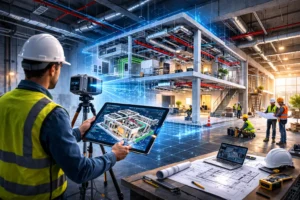
That is where 3D laser scanning comes in. Instead of trusting what the drawing says should be there (as-designed), the point cloud records with millimeter precision what is physically there (as-built), in most cases without stopping operations; our terrestrial scanners work at ±2 to 10 mm accuracy depending on the equipment and site conditions. On the projects where we replaced outdated drawings with that model, we report up to 35% less rework, 25% time savings and a 22% efficiency gain, according to the results published in our case studies.
8-minute read. By the end you will know which maintenance decision each method supports, when a traditional survey is enough, and which area of your facility to start with.
For many plants and distribution centers, October is the last construction window before the year-end peak. It is when pending work gets approved (moving racks, swapping a piece of equipment, clearing space for a new line), and almost all of it is planned on a drawing everyone treats as current because nobody has measured it again.
A supervisor signs a work order based on a twelve-year-old drawing because it is the only one there is. An auditor asks for a line’s as-built and gets the as-designed with a note that reads “modified in the field, update pending”. A manager approves an expansion trusting that the clearances “should be the same as always”. And a maintenance decision made on unverified data is still an unverified decision, even with a signature on it.
At Foundtech we work on that specific link: turning the real geometry of an operating facility into a model you check before deciding, not after something fails. We have delivered more than 200 projects across Europe and the Americas, modeled more than 10 million m², work under ISO 19650 certification and in alliance with the Swiss firm BIM Facility AG. If what you need is a comparison of capture methods by speed, accuracy and cost, we covered it in Scan to BIM vs. traditional survey. This article answers a different question: which decision each method supports once the facility is already running.
The test is not the model’s level of detail: it is which data the decision rests on
A point cloud is a record of millions of coordinates captured by a laser scanner, each with its exact position in space. It is not a photo or a render: it is a measurement of every visible surface in an area, one you can query again months later. Capturing reality this way does not require taking equipment out of service, because the scanner works without contact, and when the asset has large roofs or outdoor areas, drones complement the ground capture.
What matters is how far the as-designed can drift from the as-built without anyone noticing, until a decision depends on exactly that gap. The model’s level of detail (in BIM, the LOD, from 200 to 500) is secondary to a simpler question: does the data you are about to decide with describe the facility that was designed, or the one in front of you?
Traditional survey and Scan to BIM, decision by decision
Each type of decision has its right method. These are the four that come up most often in an operating plant or distribution center.
1. Stopping a line to work on an asset
A traditional survey measures, with a tape or a laser distance meter, the one point the technician needs. When the problem is physical (a pipe that is not where the drawing says, a support that moved, too little clearance for the tool), that spot measurement knows nothing about what happens a meter away, and every new finding means another trip to the floor. With the area captured once, the missing distance is read from the model and the shutdown is planned with certainty from the start.
2. Repairing or replacing equipment
The traditional call rests on the failure history and the judgment of the maintenance lead. What is usually missing is the real condition of the space around the equipment: whether the replacement needs an access route, requires removing something next to it, or will actually fit where the old unit sits. The model provides that condition before anyone picks up a tool, not halfway through the job.
3. Adding capacity or changing the layout
Here a traditional survey works from the as-designed drawing and, at best, a partial check of the zones that look critical. What is missing is the clash nobody drew: a beam reinforced after the original construction, a service that was rerouted, a clear height that exists on paper and not under the racks. The clash detection that is part of our BIM modeling checks the new design against the captured geometry, not the assumed one.
4. Passing an audit or a certification
A traditional survey delivers what exists: the filed drawing with whatever change notes someone remembered to add. When the auditor asks for evidence that the documentation matches actual conditions, that verified match is exactly what is missing. As-built drawings generated from the model deliver it as a document, not as a promise.
What deciding without the data costs
Missing data goes unnoticed until the decision has already gone wrong. The NIST GCR 04-867 study put the cost of inadequate interoperability in U.S. capital facilities at $15.8 billion a year, with two thirds of it absorbed by owners and operators, mostly during operations and maintenance. It measures the U.S. market, not your building, but the mechanism is the same anywhere: the cost never arrives as an invoice with its name on it. It shows up as rework, unplanned downtime or an expansion that stalls because something did not fit.
At the Werdhölzli wastewater treatment plant in Switzerland, the team realized while planning a modernization that it had no up-to-date drawings or engineering records, and a traditional survey would have taken too long. We scanned the plant, modeled its piping, tanks and structures, and the resulting digital twin then became available for maintenance and asset management. In a maintenance program, that baseline is the line item that almost never gets quoted, as we explain in how much predictive maintenance costs.
From the model to day-to-day operations
A model nobody opens supports no decision. That is why the delivery is built for the maintenance team too: editable files in Revit (RVT) or Archicad (PLA), drawings generated from the model and free viewers to check a measurement without a BIM license. The model is yours and does not lock you in with us.
When operations are ready for the next step, that same model becomes the base of a digital twin: it runs on a web platform in the browser and, through connectors to SAP, Maximo or other CMMS, work orders show up directly on the 3D model. You can start with a twin for inventory and documentation and add sensors later. At Migros Millas, roughly 11,000 m², we combined indoor scans and drone captures to map every pipe and electrical route, with the goal of improving maintenance and planning expansions. More examples in our predictive maintenance case studies.
What 3D scanning does not solve, and when a traditional survey is enough
3D laser scanning does not measure temperature or vibration, it is not part metrology (it does not replace a coordinate measuring machine for a manufacturing tolerance), and it does not replace your quality management system. If your decision depends on those variables, the scan gives you the geometric context around the problem, not the problem itself. For that layer, check which geometric data is missing from the quality management tools you already use, rather than replacing them.
A traditional survey is still the right call in specific cases: a small, stable space where nothing has changed in years, a decision that costs little if it goes wrong, or an area that will be demolished before the model gets used twice.
What the first project looks like at your plant or distribution center
The process has four stages: on-site capture and registration with a laser scanner, modeling from the point cloud, validation by overlaying the model on that same cloud to confirm there is no deviation, and delivery. A small, well-defined area can be delivered in about a week; a complex industrial building takes three to five weeks, depending on the scope we agree on.
Do not start with everything. Capturing the whole facility at maximum detail is the expensive, slow route, and it usually ends in a model nobody opens after the first month. Start with the area where not knowing costs you the most: the line with the most unplanned downtime, the asset that keeps getting repaired without a clear reason, or the zone the next audit will check first.
Scan to BIM for maintenance FAQ
Do we have to stop operations to scan?
Usually not. Scanning is done from a distance and without contact; only the aisles or zones where the equipment is set up need to be coordinated during capture.
How often does the model need updating?
There is no fixed schedule: the model stays current until new physical work is done. If you move equipment or build an expansion, only that zone is scanned again.
Does it work if the building has no reliable drawings?
Yes, and that is where it adds the most, because the model is built from the point cloud, not from earlier drawings. That was the starting point at Werdhölzli.
A simple test of whether you are there: if someone wrote “check on the floor” at your last maintenance review because the drawing and reality did not match, and that task is still open weeks later, your team has already identified the data it is missing. The traditional survey has said everything it can about that area.
Tell us which zone of your plant or distribution center generates the most work orders that never quite get closed, and we will send you the scanning scope with timelines by zone and no disruption to operations. Request the scanning scope for your facility here.